Local Public Space Mapping (P0)
A location mapping project visually analyzing and documenting spatial relationships to better understand patterns, access, and connections within a specific area.
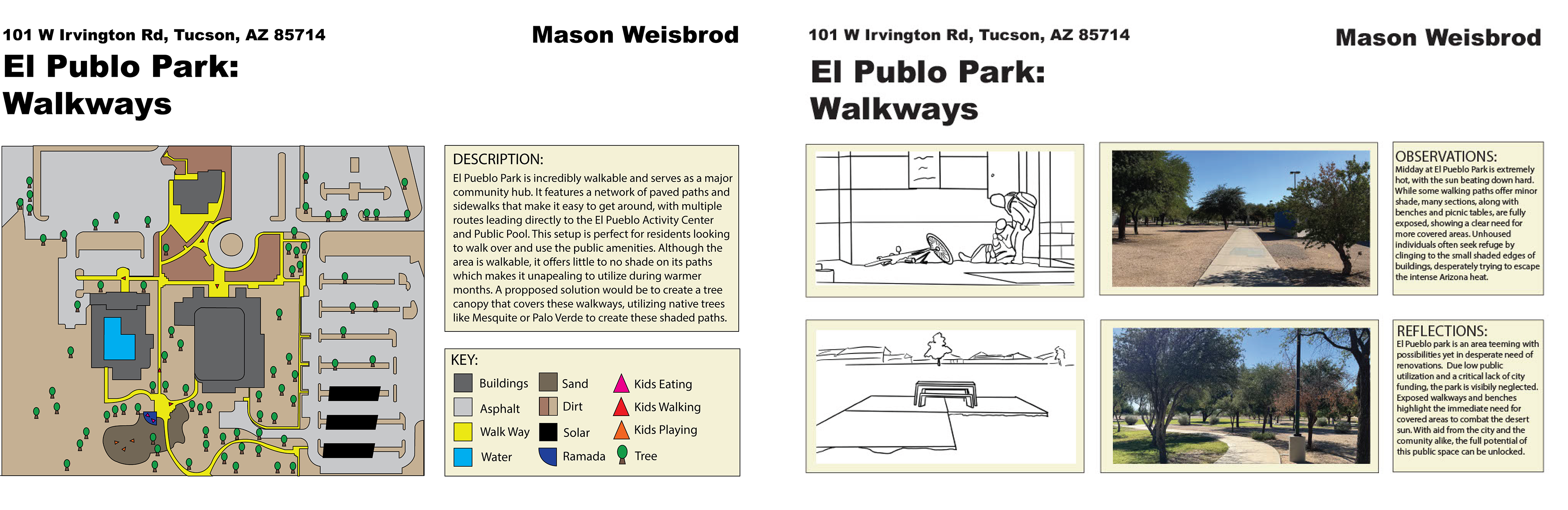
El Pueblo Mapping (P1)
A project documenting and analyzing El Pueblo park's spatial layout, surrounding area, and key community connections to better understand how the center serves its users and neighborhood.
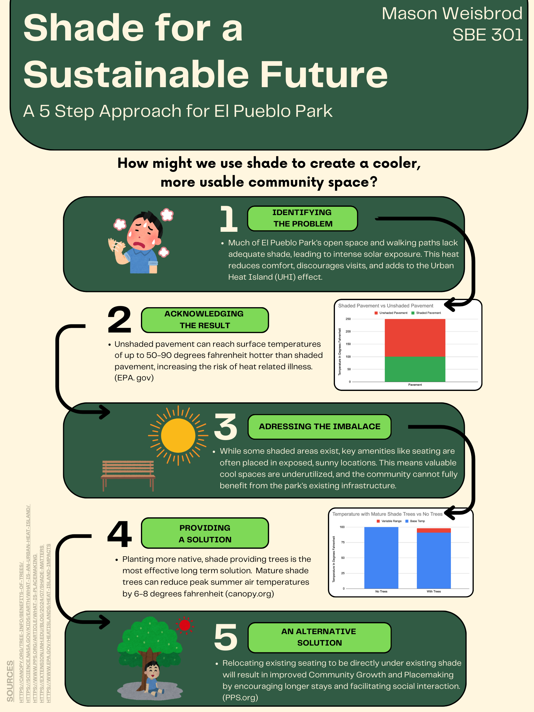
Research Infographic (P2)
A project that visually synthesizes key data and findings into a clear, engaging graphic that communicates complex information quickly and effectively in relation to El Pueblo Park

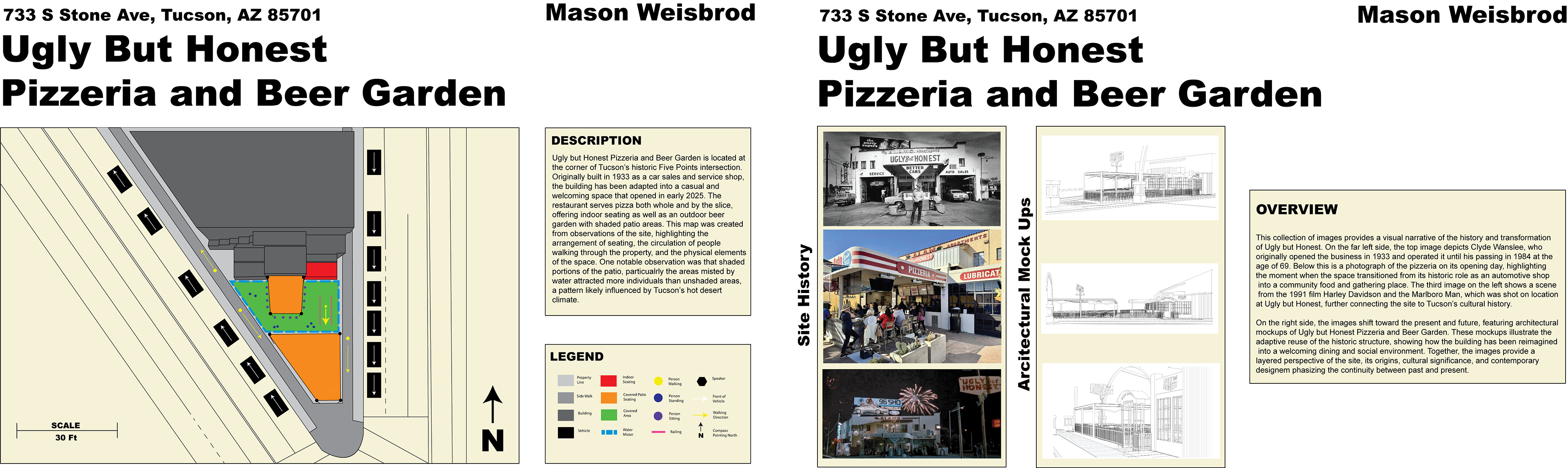
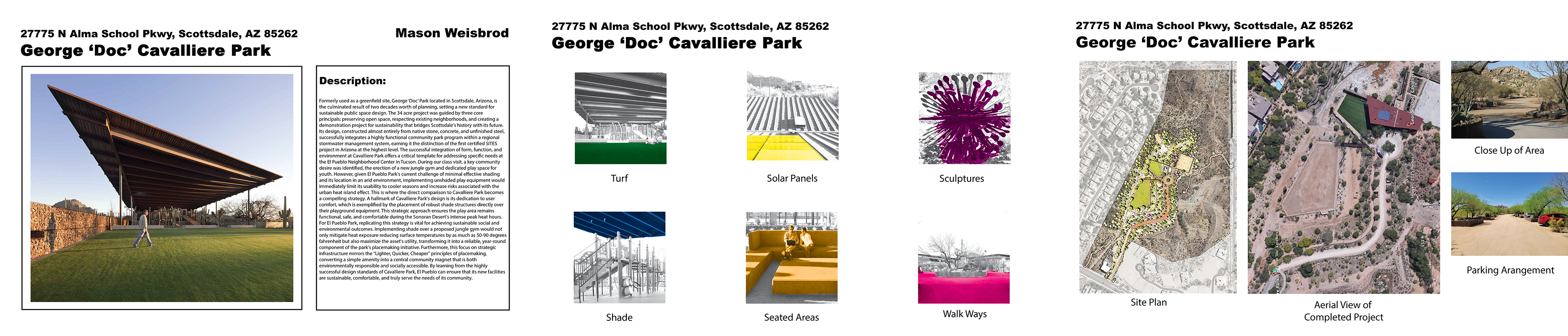
Case Study Analysis (P3)
A case study analyzes another park’s design, amenities, and spatial organization to inform improvements for the El Pueblo
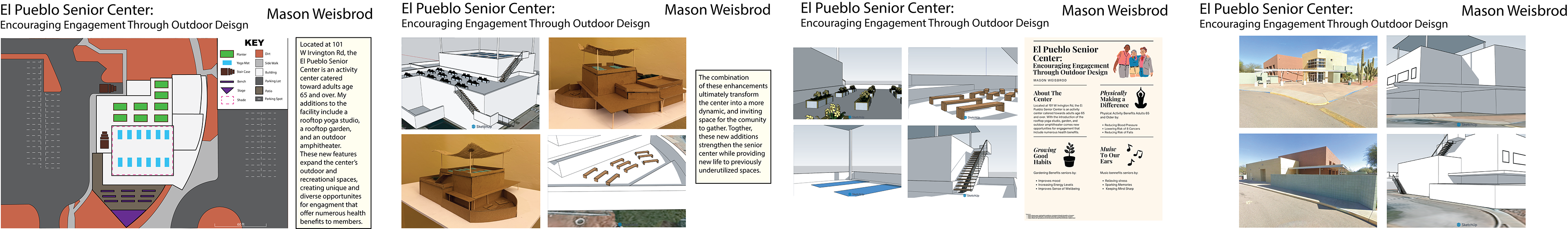
Sustainable Site Design (P4)
The final El Pueblo sustainable site design integrates research, mapping, and case study insights to create an inclusive, functional, and community focused space.
Assignment Revision (P5): Research Infographic (P2)
A revisionary assignment that improves upon the shortcomings of the initial "Research Infographic (P2)" submission